


HF Systems Help Page
By clicking on the icons or the sub-section headings you will find explanations of the data and information presented in the HF Systems Section. For general terms and definitions please refer to our Glossary of Solar Terrestrial Terms.
HF Propagation Conditions


HF Propagation Conditions


High Latitude and IPY
Global HF
Online Tools
Section Information
HF Communications Warning
An ASWFC HF Warning is issued by the ASWFC Duty Forecaster when disturbed ionospheric conditions are expected. For mid- latitudes this usually means lower than normal maximum usable frequencies. The Warning will contain the period when the disturbance is expected. During the warning period lower than normal frequencies may only be usable, and/or the quality of HF communication reduced. If you are listening to a HF broadcast that is available on several frequencies, switching to the next lowest frequency to the one you usually use may be required at times during the warning interval.

Current HF Fadeout
During a solar flare, increased ionisation in the D-layer of the ionosphere can result in greater absorption of HF signals by the D-layer and reduced signal strengths. If this icon is red a shortwave fadeout is in progress. Shortwave fadeouts affect the sunlit ionosphere and are strongest where the Sun is overhead. By clicking on the icon a map is displayed (a Fadeout Chart) centred on the longitude where the Sun is overhead. If your HF circuit has a reflection point near this sub-solar longitude, it may be disrupted by the solar flare/fadeout. Fadeouts are visible on ASWFC ionograms via the ASWFC Ionogram Viewer for Australian/New Zealand stations as an increase in the minimum vertically reflected frequency. This means lower frequencies are being absorbed and are no longer reflected from the ionosphere. During a large flare the absorption can be very strong, resulting in no return from the ionosphere of even the highest frequency HF signals. This is indicated by a blank ionogram. An HF Fadeout can last from 15 minutes to about 2 hours.
HF Fadeout Warning
An ASWFC HF Fadeout Warning is issued by the ASWFC Duty Forecaster when increased solar flare activity, and shortwave fadeouts are expected.
Polar Cap Absorption
The ionosphere in polar regions can be badly affected by high energy solar protons following a strong solar flare. Very strong ionisation of the D-region leads to absorption of HF signals similar to an HF Fadeout. This is called a Polar Cap Absorption (PCA) event. PCAs can last for several days following a large solar flare in contrast to a low/mid latitude fadeout which generally lasts just an hour or two. This icon will turn red when a PCA is in progress. The number in dB indicates the strength of the PCA. It is in fact a measure of the reduction in the galactic HF background at 30 MHz measured by Australian Antarctic Division/ASWFC Riometers situated in Antarctica.
T-index Maps
Ionospheric conditions for a particular region, relative to average levels for the time of year and solar cycle, can be observed on a T-index Map. The T-index is an ionospheric index reflecting the level of ionospheric support for HF. The T-index map shows departures in real-time from the 'predicted monthly ionospheric conditions' or quiet background level of ionospheric support. Yellow or red regions indicate unusually depressed conditions, that is, depressed foF2s and hence MUFs, relative to those expected for the time of year and solar cycle. Times are in Universal Time (UT).
HAP Charts
A HAP Chart (Hourly Area Prediction) specifies the Maximum Usable Frequency (MUF) for HF communications between the base specified and any location on the map. The colors represent the MUF for communications between that location on the map and the base selected. Thus, if communications are required to or from Canberra, a HAP chart for Canberra should be used. The other end of the circuit is then found on the HAP chart and the color at that location gives the MUF for that circuit. Hourly HAP Charts are based on real-time observed ionospheric conditions. Daily HAP Charts are based on ASWFC average maps of the ionosphere. Times are in Universal Time (UT).
HF Conditions (Australasia)
This is a collection of ASWFC reports and data related to the current conditions for HF communications in the Australasian region. foF2 plots give the variation in foF2 values measured by ASWFC ionosondes over the last 24 hours. The HF Communications Warning gives information regarding expected MUF depressions. The Ionospheric Summary and Forecast is from the ASWFC Daily Solar and Geophysical Report. The MUF report specifies the real-time foF2 values observed at all the ASWFC ionosonde stations. Finally, the results from an ASWFC Oblique Ionosonde set- up between Aukland and Sydney are presented. An oblique ionogram is a plot of propagation time (time delay) vs. frequency for an oblique (as opposed to vertical) HF propagation path. The Auckland-Sydney oblique ionogram is thus indicative of the ionosphere between Auckland and Sydney. All times are in Universal Time (UT).
Ionogram Viewer
This is a tool for viewing Australasian ionograms obtained from the ASWFC ionosonde network. A complete ionogram is generated every 5 minutes at every ionosonde station. Times are in Universal Time (UT).
Ionospheric Maps
Ionospheric Maps are regional maps of foF2, the maximum frequency reflected vertically by the ionosphere. While these maps by themselves are of limited use (near vertical HF propagation paths are not particularly useful) they represent the ionospheric data from which estimates of frequencies for any oblique circuit can be made. foF2 is the most important parameter describing the state of the ionosphere at a particular location. Along with T-index Maps, Ionospheric Maps are the key indicator of ionospheric conditions. T-index maps indicate conditions relative to the average expected, while Ionospheric Maps indicate ionospheric conditions in absolute terms. Times are in Universal Time (UT).
LAMP Charts
Local Area Mobile Predictions (LAMPs) are designed for communications between 2 HF transmitter/receivers within 1000 km of one another. Predictions are made to cover a region of 1000 km radius centred on a specified location. LAMP Charts are based on real-time (current) observed ionospheric conditions. To use a LAMP chart you need to know the distance between the mobile units. Times are in Universal Time (UT) .
T index
The T-index is a number between -50 and 250 which is generated directly from foF2 values across a region with 250 being extremely good ionospheric support and -50 extremely poor ionospheric support. The T-index has been designed to be equivalent in value to a sunspot number. Hence, it can be interpreted as: 'the ionospheric support which would normally result from an average solar activity described by such a sunspot number'. The usefulness of the T-index as an ionospheric index is that it can change during short-term ionospheric disturbances, such as those resulting from the impact of a Coronal Mass Ejection (CME) say. For example, during solar maximum the sunspot number (SSN) might be 100. A dramatic ionospheric depression at this time, resulting from a CME say, might drive the T-index from around 100 down to 20. The sunspot number would remain at 100 throughout.
A T-index Map is a regional map made in real-time of departures of the current T-index from the expected monthly (average) T-index.
Hourly HAP Charts
Hourly HAP Charts are HAP Charts based on current ionospheric conditions observed with ionosondes in the region of interest. An Hourly HAP Chart is only valid for the current hour due to the highly variable nature of the ionosphere.
Recent foF2 Plots
24-hour plots of hourly foF2 values measured at Athens, Rome and Chilton (UK) are available here for the last week.
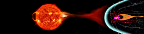
High Latitude Conditions
A collection of ASWFC products and services covering the Antarctic region are presented here. Some of the products appear elsewhere, such as the Polar Cap Absorption and Aurora alerts, while some of the products such as the HAP charts and magnetograms are specific to the Antarctic region.
International Polar Year
Follow this link to information about International Polar Year (IPY) which is in effect from March 2007 until March 2009.
High Latitude Links
A large collection of links with direct relevance to high latitude space-weather phenomena, such as geomagnetic storms and aurora, are assembled here.
HF Conditions (Global)
Provided here are links to the ASWFC Global HF Propagation Summary and to the ASWFC HF Fadeout Warning system. The Global Propagation Summary describes the general quality of HF communications to be expected at various latitudes.
Fadeout Charts
During a solar flare of large magnitude (greater than C8), sunlit portions of the globe will be affected by a Short-wave or HF Fadeout. Fadeout Charts show the portion of the globe currently affected by a HF Fadeout and the extent to which the lower HF frequencies are unusable due to absorption by the ionosphere. The color-code gives the Absorption Limiting Frequency (ALF) for a typical HF circuit of 1500 km. For circuits longer than 1500 km, the ALF or minimum usable frequency will be much higher. For shorter circuits the ALF will be slightly lower.
HF Prediction Tools
A number of Prediction Tools are made available to the public for generating a range of HF frequency guides and HF communications engineering style analysis of HF circuits. The tools all use the ASWFC ionospheric world maps which are scaled using the T-index to represent variations in solar activity. Median world maps exist for each hour of the day, for each month of the year and for different levels of solar activity. HF propagation analysis is performed using the world leading ASWFC propagation models. Advice and guidance for using each of the tools can be found by clicking the HELP button on each tool.
Index Plots
Presented here are monthly plots of the 10cm flux and the T-index. These are the key indicators of the levels of solar radiation of particular relevance to HF propagation conditions. The 10cm flux is the radio flux in sfu (solar flux units) at 2695 MHz as measured by the ASWFC/USAF Learmonth Solar Observatory. Solar radiation at this frequency is particularly associated with sunspots, plage and extreme ultra-violet (EUV) ionising radiation. The T-index (Northern and Southern Hemisphere) is a direct reflection of ionospheric support (foF2 values) and is comparable to the sunspot number.
Culgoora HF Spectrum
Displayed here is a real-time visual representation of the occupancy of the HF Band from 1 to 30 MHz. Culgoora is situated in Northern inland NSW, near to the town of Narrabri. The Culgoora site is relatively free of local RF interference and the antenna used for the gathering of the radio spectrum is a typical commercially available folded dipole. Hence, the Culgoora HF Spectrum is a good representation of transmission in the HF band at any particular time. See how a recent large solar flare affected the HF band.
HF Systems Help Page
The HF Systems Help Page gives a short explanation of the data and information provided under each sub-section of the HF Systems Section.
HF Communications Problem Page
This page contains advice on ASWFC services which assist the HF communicator in assessing and overcoming environmental factors causing HF communications problems.
Latest News
Latest News consists of recent ASWFC news items of particular relevance to HF communicatinos and to the HF Systems section of the website.